


track

PEBREJOSIANE
User
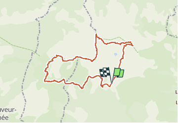

Length
18.3 km

Max alt
2636 m

Uphill gradient
1108 m
Km-Effort
33 km

Min alt
1957 m

Downhill gradient
1102 m
Boucle
Yes
Creation date :
2016-05-06 00:00:00.0
Updated on :
2016-05-06 00:00:00.0
--
Difficulty : Unknown

FREE GPS app for hiking
 SityTrail
IGN / Geographical institutes
SityTrail Plus
The world is yours!
About
Trail Other activity of 18.3 km to be discovered at Provence-Alpes-Côte d'Azur, Maritime Alps, Valdeblore. This trail is proposed by PEBREJOSIANE.
Positioning
Country:
France
Region :
Provence-Alpes-Côte d'Azur
Department/Province :
Maritime Alps
Municipality :
Valdeblore
Location:
Unknown
Start:(Dec)
Start:(UTM)
354831 ; 4884390 (32T) N.
Comments