


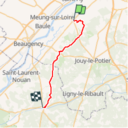
Cléry - La Ferté ST Cyr

norihtom
User

Length
26 km

Max alt
119 m

Uphill gradient
123 m
Km-Effort
27 km

Min alt
85 m

Downhill gradient
134 m
Boucle
No
Creation date :
2016-05-08 00:00:00.0
Updated on :
2016-05-08 00:00:00.0
6h07
Difficulty : Unknown

FREE GPS app for hiking
 SityTrail
IGN / Geographical institutes
SityTrail Plus
The world is yours!
About
Trail Walking of 26 km to be discovered at Centre-Loire Valley, Loiret, Cléry-Saint-André. This trail is proposed by norihtom.
Positioning
Country:
France
Region :
Centre-Loire Valley
Department/Province :
Loiret
Municipality :
Cléry-Saint-André
Location:
Unknown
Start:(Dec)
Start:(UTM)
406867 ; 5297120 (31T) N.
Comments