


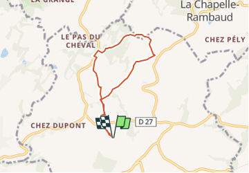
Le Frêne par le Crêt de la Buche

COMAN
User


2h00
Difficulty : Easy

FREE GPS app for hiking
 SityTrail
IGN / Geographical institutes
SityTrail Plus
The world is yours!
About
Trail Walking of 5.9 km to be discovered at Auvergne-Rhône-Alpes, Upper Savoy, Fillière. This trail is proposed by COMAN.
Description
Petite randonnée du matin partant de Le Frêne et passant vers Molety, le Crêt du Merle, Bois Noir, Crêt de la Buche,Mont béné, Crêt du Nid, La Ramuse ( A Molety le chemin passant entre les maisons en direction du Crêt du Merle est inaccessible pour cause de fermeture par les habitants)
Positioning
Comments