


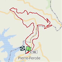
Pierre Percée

PhilippeC54
User

Length
10.8 km

Max alt
518 m

Uphill gradient
306 m
Km-Effort
14.9 km

Min alt
373 m

Downhill gradient
303 m
Boucle
Yes
Creation date :
2016-05-18 00:00:00.0
Updated on :
2016-05-18 00:00:00.0
3h12
Difficulty : Medium

FREE GPS app for hiking
 SityTrail
IGN / Geographical institutes
SityTrail Plus
The world is yours!
About
Trail Walking of 10.8 km to be discovered at Grand Est, Meurthe-et-Moselle, Pierre-Percée. This trail is proposed by PhilippeC54.
Positioning
Country:
France
Region :
Grand Est
Department/Province :
Meurthe-et-Moselle
Municipality :
Pierre-Percée
Location:
Unknown
Start:(Dec)
Start:(UTM)
346996 ; 5370644 (32U) N.
Comments