


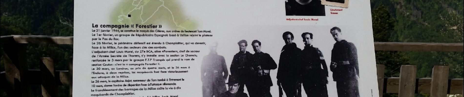
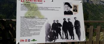
plateau des Glières par le pas du Roc

cailloux54
User
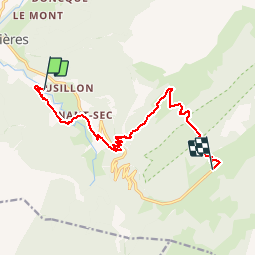

Length
12.5 km

Max alt
1595 m

Uphill gradient
1038 m
Km-Effort
24 km

Min alt
667 m

Downhill gradient
273 m
Boucle
No
Creation date :
2016-11-30 00:00:00.0
Updated on :
2016-11-30 00:00:00.0
3h41
Difficulty : Medium

FREE GPS app for hiking
 SityTrail
IGN / Geographical institutes
SityTrail Plus
The world is yours!
About
Trail Walking of 12.5 km to be discovered at Auvergne-Rhône-Alpes, Upper Savoy, Fillière. This trail is proposed by cailloux54.
Photos


Positioning
Country:
France
Region :
Auvergne-Rhône-Alpes
Department/Province :
Upper Savoy
Municipality :
Fillière
Location:
Thorens-Glières
Start:(Dec)
Start:(UTM)
288680 ; 5095909 (32T) N.
Comments