


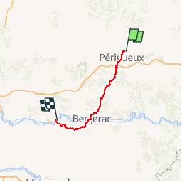
8 Périgueux-Sainte Foy-La Grande- St Jacques de Compostelle

nicolas54230
User

Length
99 km

Max alt
238 m

Uphill gradient
1700 m
Km-Effort
122 km

Min alt
16 m

Downhill gradient
1916 m
Boucle
No
Creation date :
2016-06-07 00:00:00.0
Updated on :
2016-06-07 00:00:00.0
7h47
Difficulty : Difficult

FREE GPS app for hiking
 SityTrail
IGN / Geographical institutes
SityTrail Plus
The world is yours!
About
Trail Mountain bike of 99 km to be discovered at New Aquitaine, Dordogne, Champcevinel. This trail is proposed by nicolas54230.
Description
St-Jacques-de-Compostelle en VTT.
Positioning
Country:
France
Region :
New Aquitaine
Department/Province :
Dordogne
Municipality :
Champcevinel
Location:
Unknown
Start:(Dec)
Start:(UTM)
323512 ; 5009686 (31T) N.
Comments