


CTM Mont Ventoux

PhilippeC54
User

Length
88 km

Max alt
1910 m

Uphill gradient
2286 m
Km-Effort
118 km

Min alt
203 m

Downhill gradient
2285 m
Boucle
Yes
Creation date :
2016-05-24 00:00:00.0
Updated on :
2016-05-24 00:00:00.0
6h48
Difficulty : Very difficult

FREE GPS app for hiking
 SityTrail
IGN / Geographical institutes
SityTrail Plus
The world is yours!
About
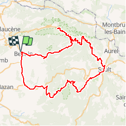
Trail Cycle of 88 km to be discovered at Provence-Alpes-Côte d'Azur, Vaucluse, Bédoin. This trail is proposed by PhilippeC54.
Description
Bédoin
Mont Ventoux
Sault
Gorges de la Nesque
Mormoiron
Positioning
Country:
France
Region :
Provence-Alpes-Côte d'Azur
Department/Province :
Vaucluse
Municipality :
Bédoin
Location:
Unknown
Start:(Dec)
Start:(UTM)
674005 ; 4888327 (31T) N.
Comments