Trail Walking Fontainebleau - M&R-160311 - Canon-Evées - Photo

M&R-160311 - Canon-Evées

 randodan
randodan

User

© OpenStreetMap contributors
Length
Length
13.2 km
Max alt
Max alt
138 m
Uphill gradient
Uphill gradient
169 m
Km-Effort
Km-Effort  
15.5 km
Min alt
Min alt
81 m
Downhill gradient
Downhill gradient
167 m
Boucle
Boucle
Yes
Creation date :
2016-06-04 00:00:00.0
Updated on :
2016-06-04 00:00:00.0

(0 Reviews)

Walking
Walking
5h20
Difficulty : Easy

Scan this QR Code to open this trail in the SityTrail application

FREE GPS app for hiking

Logo SityTrail SityTrail

IGN / Geographical institutes

Download SityTrail from the App Store Download SityTrail from Google Play

Logo SityTrail SityTrail Plus

The world is yours!

Download SityTrail from the App Store Download SityTrail from Google Play Download SityTrail on Huawei AppGallery

About

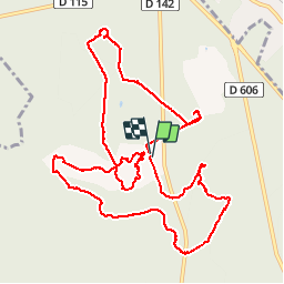
Trail Walking of 13.2 km to be discovered at Ile-de-France, Seine-et-Marne, Fontainebleau. This trail is proposed by randodan.

Description

Rocher Canon et Mare aux Evées avec Marche et Rêve<br>
- 3 mars 2016 -<br>
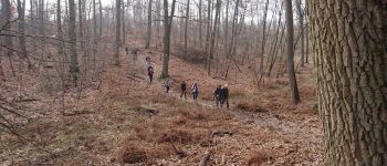
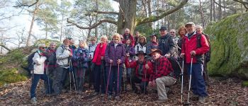
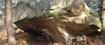
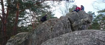
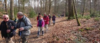
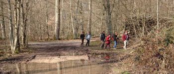
Départ 9h45 cap Sud-Sud-Est . Petit crochet pour aller voir une ancienne carrière, mais boaf, rien à voir . 10h45, pause biberon sur la Table du Grand Maître (datée de 1723, déplacée en 1950 lors de la restauration de la Route Ronde) . Route Tournante des Longues Vallées, Denecourt n°12, photo de famille sous le beau chêne du Forum, et on attaque le massif du Rocher Canon.<br>
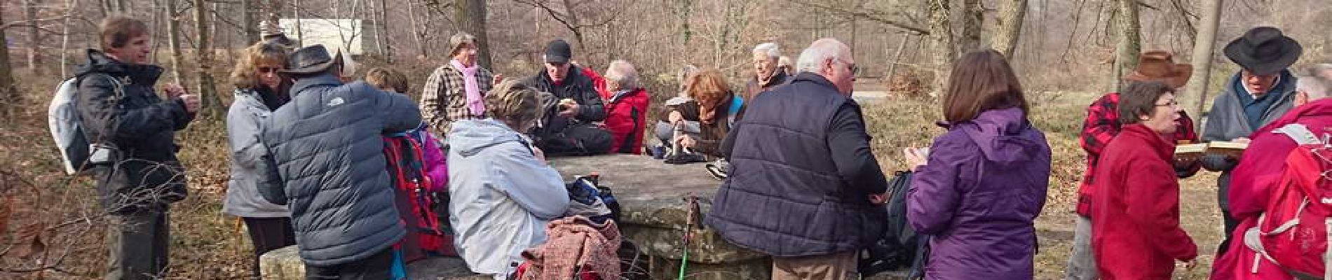
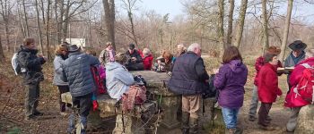
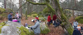
12h20, on se pose dans notre petite clairière habituelle pour le pique-nique.<br>
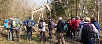
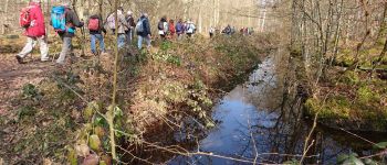
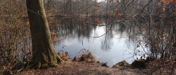
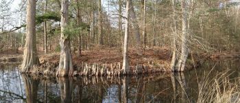
13h15, on repart et Jean-Marie nous rejoint pour continuer le circuit en passant par le Canon . Puis direction plein Nord, le puits de pétrole et la Mare aux Evées . Ensuite, cap Sud-Est jusqu'à la Mare aux Cerfs et ses magnifiques Cyprès Chauves et leurs <a href="https://fr.wikipedia.org/wiki/Pneumatophore" TARGET="_blank"><u><i>pneumatophores</i></u></a>.<br>
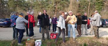
16h, de retour au parking pour le cidre et les gâteaux.<br>
29 participants sous un doux soleil qui s'est trouvé un peu timide juste le temps du pique-nique.

Elevation profile

Photos

Points of interest

Point of interest Fontainebleau - 01 - Pause biberon sur la Table du Grand Maître - Photo
randodan
Point of interest Fontainebleau - 02 - Un beau sentier - Photo
randodan
FONTAINEBLEAU 
Point of interest Fontainebleau - 03 - Tentative de nidification d'un pic vert - Photo
randodan
Point of interest Fontainebleau - 04 - Photo de famille - Photo
randodan
FONTAINEBLEAU 
Point of interest Fontainebleau - 05 - L'Abri (D) - Photo
randodan
FONTAINEBLEAU 
Point of interest Fontainebleau - 06 - Le Piège (E) - Photo
randodan
FONTAINEBLEAU 
Point of interest Fontainebleau - 07 - Le pique-nique - Photo
randodan
FONTAINEBLEAU 
Point of interest Fontainebleau - 08 - A l'assaut du Canon - Photo
randodan
Point of interest Fontainebleau - 09 - Sur la Route de Dammarie - Photo
randodan
Point of interest Fontainebleau - 10 - Le Puits de Pétrole - Photo
randodan
Point of interest Fontainebleau - 11 - Le long d'un des fossés de la Mare aux Evées - Photo
randodan
Point of interest Fontainebleau - 12 - La Mare aux Evées - Photo
randodan
Point of interest Fontainebleau - 13 - Gadoue-gadoue - Photo
randodan
FONTAINEBLEAU 
Point of interest Fontainebleau - 14 - La Mare aux Cerfs - Photo
randodan
FONTAINEBLEAU 
Point of interest Fontainebleau - 15 - Cidre et gâteaux - Photo
randodan
FONTAINEBLEAU 

Positioning

Country:
France
Region :
Ile-de-France
Department/Province :
Seine-et-Marne
Municipality :
Fontainebleau
Location:
Unknown
Start:(UTM)
475309 ; 5367815 (31U) N.


Close
My subscriptions