


20190630R

Frings
User

Length
22 km

Max alt
226 m

Uphill gradient
221 m
Km-Effort
24 km

Min alt
145 m

Downhill gradient
155 m
Boucle
No
Creation date :
2016-06-30 00:00:00.0
Updated on :
2016-06-30 00:00:00.0
51m
Difficulty : Unknown

FREE GPS app for hiking
 SityTrail
IGN / Geographical institutes
SityTrail Plus
The world is yours!
About
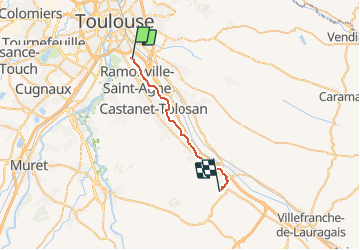
Trail Cycle of 22 km to be discovered at Occitania, Haute-Garonne, Toulouse. This trail is proposed by Frings.
Positioning
Country:
France
Region :
Occitania
Department/Province :
Haute-Garonne
Municipality :
Toulouse
Location:
Unknown
Start:(Dec)
Start:(UTM)
376380 ; 4824888 (31T) N.
Comments