Forêt Olonne Sainte Emilienne

Gascon
User
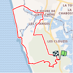

Length
10 km

Max alt
33 m

Uphill gradient
73 m
Km-Effort
11 km

Min alt
0 m

Downhill gradient
74 m
Boucle
Yes
Creation date :
2016-07-01 00:00:00.0
Updated on :
2016-07-01 00:00:00.0
2h29
Difficulty : Easy

FREE GPS app for hiking
 SityTrail
IGN / Geographical institutes
SityTrail Plus
The world is yours!
About
Trail Walking of 10 km to be discovered at Pays de la Loire, Vendée, Les Sables-d'Olonne. This trail is proposed by Gascon.
Positioning
Country:
France
Region :
Pays de la Loire
Department/Province :
Vendée
Municipality :
Les Sables-d'Olonne
Location:
Olonne-sur-Mer
Start:(Dec)
Start:(UTM)
590175 ; 5158740 (30T) N.
Comments