


Pas de l'arpette

kenhava
User
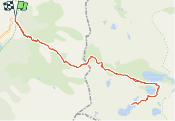

Length
16 km

Max alt
2510 m

Uphill gradient
1342 m
Km-Effort
34 km

Min alt
1685 m

Downhill gradient
1341 m
Boucle
Yes
Creation date :
2016-07-04 00:00:00.0
Updated on :
2016-07-04 00:00:00.0
3h42
Difficulty : Difficult

FREE GPS app for hiking
 SityTrail
IGN / Geographical institutes
SityTrail Plus
The world is yours!
About
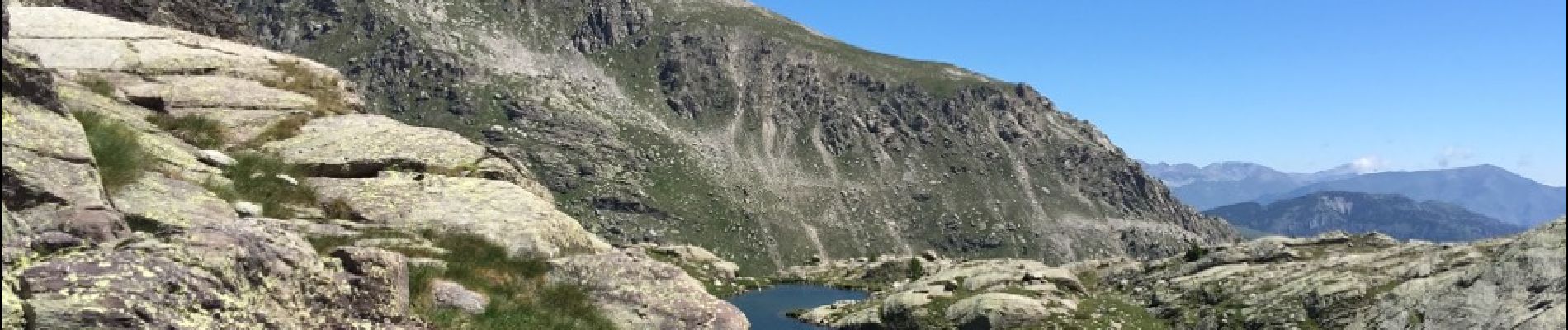
Trail Running of 16 km to be discovered at Provence-Alpes-Côte d'Azur, Maritime Alps, Belvédère. This trail is proposed by kenhava.
Photos


Positioning
Country:
France
Region :
Provence-Alpes-Côte d'Azur
Department/Province :
Maritime Alps
Municipality :
Belvédère
Location:
Unknown
Start:(Dec)
Start:(UTM)
371979 ; 4881349 (32T) N.
Comments