


corrençon - la sambue - pas de l'âne

maupassant38
User
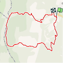

Length
11.9 km

Max alt
1567 m

Uphill gradient
488 m
Km-Effort
18.4 km

Min alt
1143 m

Downhill gradient
486 m
Boucle
Yes
Creation date :
2019-02-22 22:31:14.589
Updated on :
2019-02-22 22:31:14.604
3h48
Difficulty : Medium

FREE GPS app for hiking
 SityTrail
IGN / Geographical institutes
SityTrail Plus
The world is yours!
About
Trail Walking of 11.9 km to be discovered at Auvergne-Rhône-Alpes, Isère, Corrençon-en-Vercors. This trail is proposed by maupassant38.
Positioning
Country:
France
Region :
Auvergne-Rhône-Alpes
Department/Province :
Isère
Municipality :
Corrençon-en-Vercors
Location:
Unknown
Start:(Dec)
Start:(UTM)
698320 ; 4988737 (31T) N.
Comments