


puy mari

bellouelo46
User

Length
75 km

Max alt
1589 m

Uphill gradient
1534 m
Km-Effort
95 km

Min alt
633 m

Downhill gradient
1533 m
Boucle
Yes
Creation date :
2016-07-05 00:00:00.0
Updated on :
2016-07-05 00:00:00.0
5h23
Difficulty : Medium

FREE GPS app for hiking
 SityTrail
IGN / Geographical institutes
SityTrail Plus
The world is yours!
About
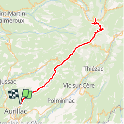
Trail Cycle of 75 km to be discovered at Auvergne-Rhône-Alpes, Cantal, Aurillac. This trail is proposed by bellouelo46.
Positioning
Country:
France
Region :
Auvergne-Rhône-Alpes
Department/Province :
Cantal
Municipality :
Aurillac
Location:
Unknown
Start:(Dec)
Start:(UTM)
457265 ; 4976607 (31T) N.
Comments