


Daouet matin

nolsim
User
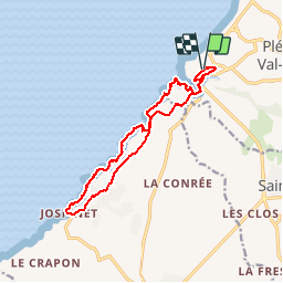

Length
13.4 km

Max alt
67 m

Uphill gradient
264 m
Km-Effort
16.9 km

Min alt
0 m

Downhill gradient
265 m
Boucle
Yes
Creation date :
2018-08-18 14:07:54.563
Updated on :
2018-08-18 14:07:54.563
3h19
Difficulty : Medium

FREE GPS app for hiking
 SityTrail
IGN / Geographical institutes
SityTrail Plus
The world is yours!
About
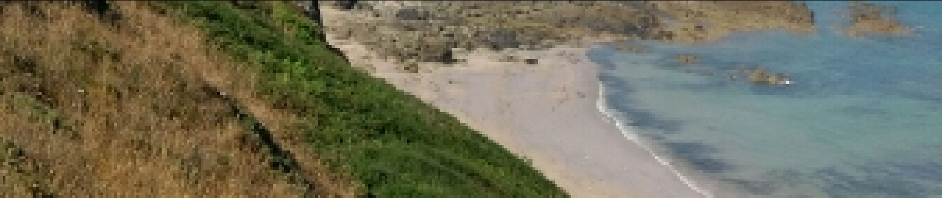
Trail Walking of 13.4 km to be discovered at Brittany, Côtes-d'Armor, Pléneuf-Val-André. This trail is proposed by nolsim.
Photos


Positioning
Country:
France
Region :
Brittany
Department/Province :
Côtes-d'Armor
Municipality :
Pléneuf-Val-André
Location:
Unknown
Start:(Dec)
Start:(UTM)
532235 ; 5380963 (30U) N.
Comments