


Tarentaise

ramsay
User
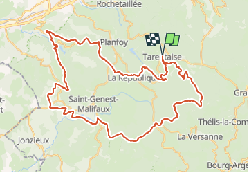

Length
51 km

Max alt
1303 m

Uphill gradient
1326 m
Km-Effort
69 km

Min alt
705 m

Downhill gradient
1325 m
Boucle
Yes
Creation date :
2017-09-11 00:00:00.0
Updated on :
2017-09-11 00:00:00.0
4h25
Difficulty : Medium

FREE GPS app for hiking
 SityTrail
IGN / Geographical institutes
SityTrail Plus
The world is yours!
About
Trail Mountain bike of 51 km to be discovered at Auvergne-Rhône-Alpes, Loire, Tarentaise. This trail is proposed by ramsay.
Description
Parcours 50 km. Très beau parcours dans le Pilat. Assez roulant malgré quelques passages techniques.
Positioning
Country:
France
Region :
Auvergne-Rhône-Alpes
Department/Province :
Loire
Municipality :
Tarentaise
Location:
Unknown
Start:(Dec)
Start:(UTM)
616595 ; 5025608 (31T) N.
Comments