


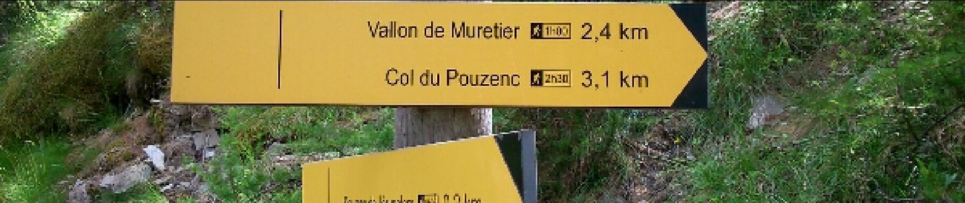
Le Vallon de Muretier

Gegetop
User
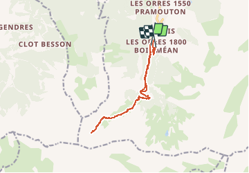

Length
13.8 km

Max alt
2357 m

Uphill gradient
783 m
Km-Effort
24 km

Min alt
1662 m

Downhill gradient
716 m
Boucle
No
Creation date :
2016-08-03 00:00:00.0
Updated on :
2016-08-03 00:00:00.0
4h52
Difficulty : Medium

FREE GPS app for hiking
 SityTrail
IGN / Geographical institutes
SityTrail Plus
The world is yours!
About
Trail Nordic walking of 13.8 km to be discovered at Provence-Alpes-Côte d'Azur, Hautes-Alpes, Les Orres. This trail is proposed by Gegetop.
Description
Magnifique randonnée.
Si vous êtes discret vous aurez la chance d'approcher des marmottes.
Photos


Positioning
Country:
France
Region :
Provence-Alpes-Côte d'Azur
Department/Province :
Hautes-Alpes
Municipality :
Les Orres
Location:
Unknown
Start:(Dec)
Start:(UTM)
305225 ; 4928646 (32T) N.
Comments