


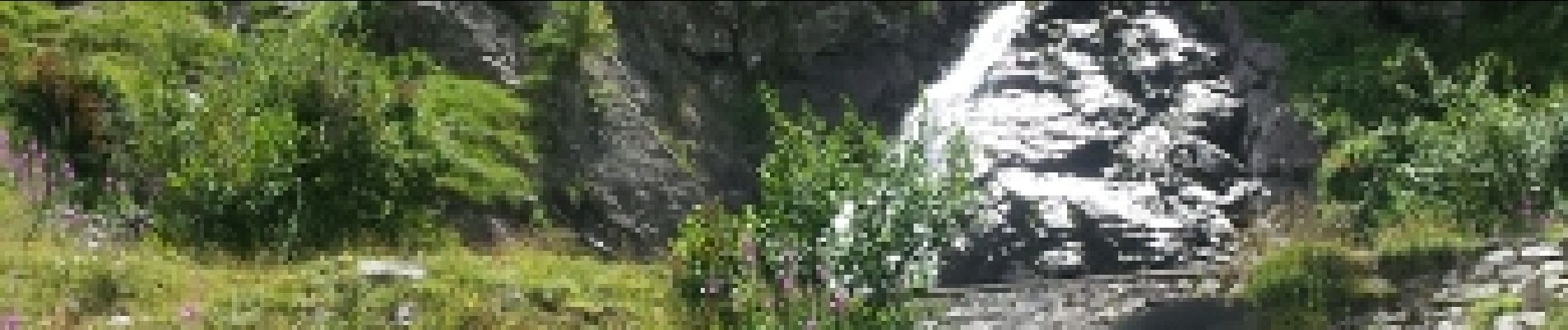
Boucle vers la cascade de Presley - 05 août 2016

morganee
User
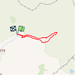

Length
9.6 km

Max alt
1828 m

Uphill gradient
367 m
Km-Effort
14.5 km

Min alt
1470 m

Downhill gradient
360 m
Boucle
Yes
Creation date :
2019-07-19 19:06:01.845
Updated on :
2019-07-19 19:06:01.905
2h56
Difficulty : Easy

FREE GPS app for hiking
 SityTrail
IGN / Geographical institutes
SityTrail Plus
The world is yours!
About
Trail Walking of 9.6 km to be discovered at Provence-Alpes-Côte d'Azur, Hautes-Alpes, Champoléon. This trail is proposed by morganee.
Photos

Positioning
Country:
France
Region :
Provence-Alpes-Côte d'Azur
Department/Province :
Hautes-Alpes
Municipality :
Champoléon
Location:
Unknown
Start:(Dec)
Start:(UTM)
284739 ; 4960177 (32T) N.
Comments