


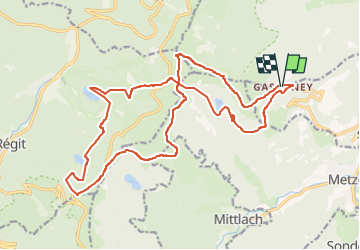
07,08,16-Gaschney-Landes-Blanchemer-Kastelberg-Falimont-Gaschney

delm
User

Length
22 km

Max alt
1338 m

Uphill gradient
963 m
Km-Effort
35 km

Min alt
923 m

Downhill gradient
958 m
Boucle
Yes
Creation date :
2016-09-02 00:00:00.0
Updated on :
2016-09-02 00:00:00.0
7h04
Difficulty : Difficult

FREE GPS app for hiking
 SityTrail
IGN / Geographical institutes
SityTrail Plus
The world is yours!
About
Trail Walking of 22 km to be discovered at Grand Est, Haut-Rhin, Stosswihr. This trail is proposed by delm.
Positioning
Country:
France
Region :
Grand Est
Department/Province :
Haut-Rhin
Municipality :
Stosswihr
Location:
Unknown
Start:(Dec)
Start:(UTM)
354366 ; 5321956 (32U) N.
Comments
Très belle randonnée avec des reliefs variés