


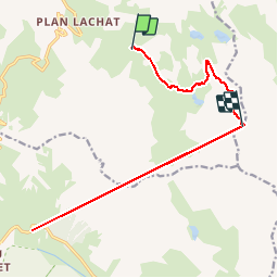
Pointe des Cerces

whisper73
User

Length
17.6 km

Max alt
3071 m

Uphill gradient
3192 m
Km-Effort
57 km

Min alt
1911 m

Downhill gradient
2276 m
Boucle
No
Creation date :
2016-09-19 00:00:00.0
Updated on :
2016-09-19 00:00:00.0
2h17
Difficulty : Unknown

FREE GPS app for hiking
 SityTrail
IGN / Geographical institutes
SityTrail Plus
The world is yours!
About
Trail Walking of 17.6 km to be discovered at Auvergne-Rhône-Alpes, Savoy, Valloire. This trail is proposed by whisper73.
Positioning
Country:
France
Region :
Auvergne-Rhône-Alpes
Department/Province :
Savoy
Municipality :
Valloire
Location:
Unknown
Start:(Dec)
Start:(UTM)
299573 ; 4995280 (32T) N.
Comments