


Chapelle (trou de la)

Patricelecerf
User
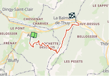

Length
11.4 km

Max alt
1563 m

Uphill gradient
920 m
Km-Effort
24 km

Min alt
583 m

Downhill gradient
983 m
Boucle
No
Creation date :
2016-08-18 00:00:00.0
Updated on :
2016-08-18 00:00:00.0
5h03
Difficulty : Medium

FREE GPS app for hiking
 SityTrail
IGN / Geographical institutes
SityTrail Plus
The world is yours!
About
Trail Walking of 11.4 km to be discovered at Auvergne-Rhône-Alpes, Upper Savoy, Alex. This trail is proposed by Patricelecerf.
Description
17.08.16
Positioning
Country:
France
Region :
Auvergne-Rhône-Alpes
Department/Province :
Upper Savoy
Municipality :
Alex
Location:
Unknown
Start:(Dec)
Start:(UTM)
285571 ; 5084821 (32T) N.
Comments