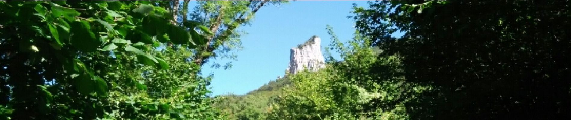
tour st jacques depuis son parking

COMAN
User
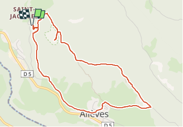

Length
5.4 km

Max alt
917 m

Uphill gradient
301 m
Km-Effort
9.4 km

Min alt
645 m

Downhill gradient
303 m
Boucle
Yes
Creation date :
2016-08-25 00:00:00.0
Updated on :
2016-08-25 00:00:00.0
2h03
Difficulty : Easy

FREE GPS app for hiking
 SityTrail
IGN / Geographical institutes
SityTrail Plus
The world is yours!
About
Trail Walking of 5.4 km to be discovered at Auvergne-Rhône-Alpes, Upper Savoy, Allèves. This trail is proposed by COMAN.
Photos


Positioning
Country:
France
Region :
Auvergne-Rhône-Alpes
Department/Province :
Upper Savoy
Municipality :
Allèves
Location:
Unknown
Start:(Dec)
Start:(UTM)
272149 ; 5071829 (32T) N.
Comments