Trail Walking Saint-Pardoux - St_Pardoux_Montatraux - Photo
 jagarnier
jagarnier

User GUIDE

© OpenStreetMap contributors
Length
Length
11.4 km
Max alt
Max alt
668 m
Uphill gradient
Uphill gradient
212 m
Km-Effort
Km-Effort  
14.2 km
Min alt
Min alt
581 m
Downhill gradient
Downhill gradient
213 m
Boucle
Boucle
Yes
Creation date :
2016-08-23 00:00:00.0
Updated on :
2023-11-15 11:56:47.638

(0 Reviews)

Walking
Walking
3h30
Difficulty : Medium

Scan this QR Code to open this trail in the SityTrail application

FREE GPS app for hiking

Logo SityTrail SityTrail

IGN / Geographical institutes

Download SityTrail from the App Store Download SityTrail from Google Play

Logo SityTrail SityTrail World

The world is yours!

Download SityTrail from the App Store Download SityTrail from Google Play Download SityTrail on Huawei AppGallery

About

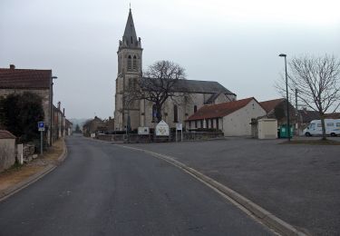
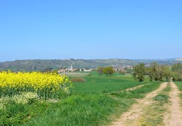
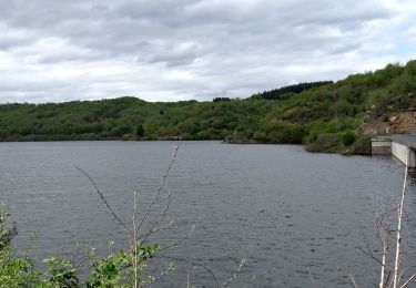
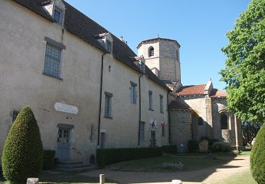
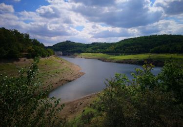
Trail Walking of 11.4 km to be discovered at Auvergne-Rhône-Alpes, Puy-de-Dôme, Saint-Pardoux. This trail is proposed by jagarnier.

Description

Ce circuit, au départ de St-Pardoux, se déroule sur des pistes peu accidentées. Le promontoire de Montatraux avec son aire de repos et sa table d'orientation, nous révèle le paysage jusqu'à la chaine des Puys.

Elevation profile

Photos

Positioning

Country:
France
Region :
Auvergne-Rhône-Alpes
Department/Province :
Puy-de-Dôme
Municipality :
Saint-Pardoux
Location:
Unknown
Start:(UTM)
501197 ; 5100383 (31T) N.

Trails nearby

Trail Walking Blot-l'Église - Blot_Eglise_Pery - Photo
Walking
GUIDE
jagarnier

Walking

Easy
(1)
Blot-l'Église, Auvergne-Rhône-Alpes, Puy-de-Dôme, France
9.8 km | 12.1 km-effort
3h 0min
Yes
Trail Walking Saint-Hilaire-la-Croix - Entre Sep et Morges - Photo
Walking
Gegetop

Walking

Medium
(1)
Saint-Hilaire-la-Croix, Auvergne-Rhône-Alpes, Puy-de-Dôme, France
14.6 km | 19.7 km-effort
3h 40min
Yes
Trail On foot Marcillat - Tour de Mathas - Photo
On foot
PRO

On foot

Easy
Marcillat, Auvergne-Rhône-Alpes, Puy-de-Dôme, France
13.4 km | 17.9 km-effort
4h 3min
Yes
Trail Walking Saint-Quintin-sur-Sioule - St_Quintin_Source_Charponne - Photo
Walking
GUIDE
jagarnier

Walking

Medium
Saint-Quintin-sur-Sioule, Auvergne-Rhône-Alpes, Puy-de-Dôme, France
12.9 km | 16.6 km-effort
3h 45min
Yes
Trail Walking Saint-Hilaire-la-Croix - St_Hilaire_Sep_Morge - Photo
Walking
GUIDE
jagarnier

Walking

Medium
Saint-Hilaire-la-Croix, Auvergne-Rhône-Alpes, Puy-de-Dôme, France
13.9 km | 19 km-effort
4h 15min
Yes
Trail On foot Saint-Hilaire-la-Croix - Entre Sep et la Morge - Photo
On foot
PRO

On foot

Easy
Saint-Hilaire-la-Croix, Auvergne-Rhône-Alpes, Puy-de-Dôme, France
14 km | 19.1 km-effort
4h 20min
Yes
Trail Walking Blot-l'Église - Le barrage de la Sep  - Photo
Walking
Gegetop

Walking

Very easy
Blot-l'Église, Auvergne-Rhône-Alpes, Puy-de-Dôme, France
13.6 km | 17.7 km-effort
3h 40min
Yes
Trail Walking Montcel - Montcel_Pierre_Branlante - Photo
Walking
GUIDE
jagarnier

Walking

Medium
(1)
Montcel, Auvergne-Rhône-Alpes, Puy-de-Dôme, France
11 km | 14.4 km-effort
3h 15min
Yes
Trail Walking Saint-Pardoux - St_Pardoux_Barrage_Sep - Photo
Walking
GUIDE
jagarnier

Walking

Medium
Saint-Pardoux, Auvergne-Rhône-Alpes, Puy-de-Dôme, France
10.5 km | 13.6 km-effort
3h 0min
Yes


Close
My subscriptions