


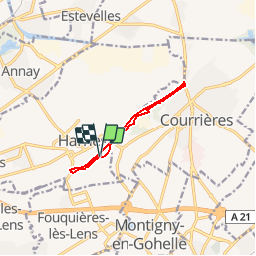
harnes le long du canal

dehemjacques
User

Length
7.6 km

Max alt
33 m

Uphill gradient
35 m
Km-Effort
8.1 km

Min alt
20 m

Downhill gradient
34 m
Boucle
Yes
Creation date :
2016-08-24 00:00:00.0
Updated on :
2016-08-24 00:00:00.0
1h13
Difficulty : Easy

FREE GPS app for hiking
 SityTrail
IGN / Geographical institutes
SityTrail Plus
The world is yours!
About
Trail Nordic walking of 7.6 km to be discovered at Hauts-de-France, Pas-de-Calais, Harnes. This trail is proposed by dehemjacques.
Description
passage des bâtons d'or en marche nordique
Positioning
Country:
France
Region :
Hauts-de-France
Department/Province :
Pas-de-Calais
Municipality :
Harnes
Location:
Unknown
Start:(Dec)
Start:(UTM)
493838 ; 5588006 (31U) N.
Comments