


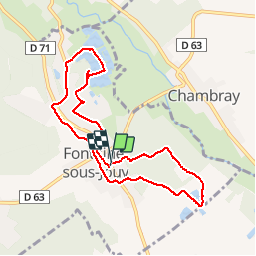
Fontaine sous jouy

vagalam49
User

Length
8.5 km

Max alt
46 m

Uphill gradient
58 m
Km-Effort
9.2 km

Min alt
28 m

Downhill gradient
58 m
Boucle
Yes
Creation date :
2016-08-29 00:00:00.0
Updated on :
2016-08-29 00:00:00.0
2h19
Difficulty : Easy

FREE GPS app for hiking
 SityTrail
IGN / Geographical institutes
SityTrail Plus
The world is yours!
About
Trail Walking of 8.5 km to be discovered at Normandy, Eure, Fontaine-sous-Jouy. This trail is proposed by vagalam49.
Positioning
Country:
France
Region :
Normandy
Department/Province :
Eure
Municipality :
Fontaine-sous-Jouy
Location:
Unknown
Start:(Dec)
Start:(UTM)
375307 ; 5436180 (31U) N.
Comments
souvent des erreurs. Enregistrement de randonnée non effectues