


LA PIERRE PERCÉE-PIERRE CHATEL-29-08-2016

RD78-38
User
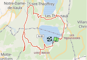

Length
13.6 km

Max alt
1275 m

Uphill gradient
445 m
Km-Effort
19.5 km

Min alt
932 m

Downhill gradient
447 m
Boucle
Yes
Creation date :
2016-09-04 00:00:00.0
Updated on :
2020-07-11 00:22:51.629
4h13
Difficulty : Very easy

FREE GPS app for hiking
 SityTrail
IGN / Geographical institutes
SityTrail Plus
The world is yours!
About
Trail Walking of 13.6 km to be discovered at Auvergne-Rhône-Alpes, Isère, Pierre-Châtel. This trail is proposed by RD78-38.
Description
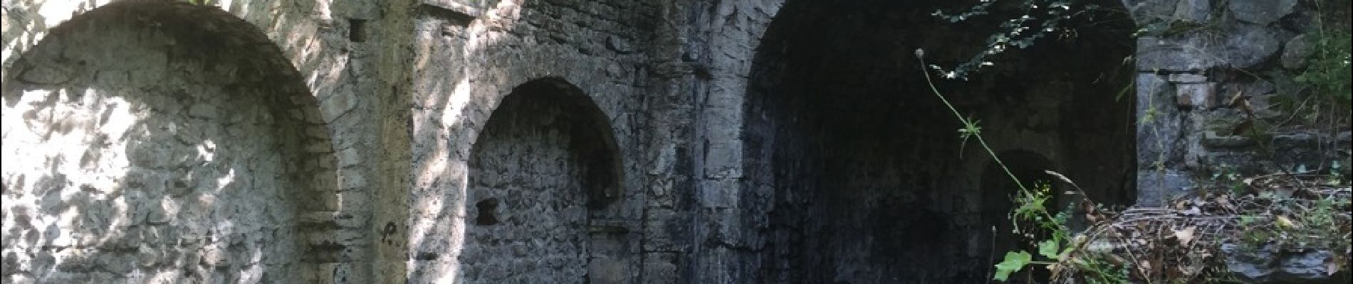
Ballade plus que Randonnée. Aller et retour vers la pierre percée sans grand intérêt (aucune vue, traversée d'une forêt seulement). Seule la pierre percée et sa vue présentent un intérêt.
Photos


Positioning
Country:
France
Region :
Auvergne-Rhône-Alpes
Department/Province :
Isère
Municipality :
Pierre-Châtel
Location:
Unknown
Start:(Dec)
Start:(UTM)
719248 ; 4983213 (31T) N.
Comments