


ISOLA- LAC TAVELS

ch2slv
User
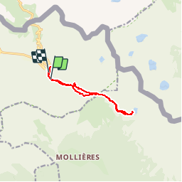

Length
10.8 km

Max alt
2347 m

Uphill gradient
537 m
Km-Effort
18 km

Min alt
2018 m

Downhill gradient
549 m
Boucle
No
Creation date :
2016-09-07 00:00:00.0
Updated on :
2016-09-07 00:00:00.0
4h50
Difficulty : Unknown

FREE GPS app for hiking
 SityTrail
IGN / Geographical institutes
SityTrail Plus
The world is yours!
About
Trail Other activity of 10.8 km to be discovered at Provence-Alpes-Côte d'Azur, Maritime Alps, Isola. This trail is proposed by ch2slv.
Description
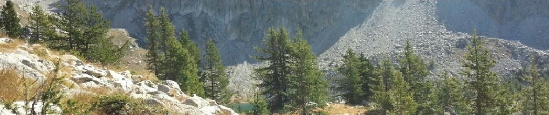
Belle vue du Col Mercière puis chemin à flanc qui se perd 1 peu dans les éboulis, enfin 2 voies pour rejoindre le lac.
La voie retour est plus facile
Photos


Positioning
Country:
France
Region :
Provence-Alpes-Côte d'Azur
Department/Province :
Maritime Alps
Municipality :
Isola
Location:
Unknown
Start:(Dec)
Start:(UTM)
353022 ; 4893824 (32T) N.
Comments