


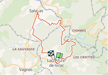
PREPA Ardèche J3 - LabastideVirac-Rieussec-Savalas

randodan
User

Length
18.3 km

Max alt
400 m

Uphill gradient
534 m
Km-Effort
25 km

Min alt
79 m

Downhill gradient
552 m
Boucle
Yes
Creation date :
2016-09-13 00:00:00.0
Updated on :
2016-09-13 00:00:00.0
10m
Difficulty : Unknown

FREE GPS app for hiking
 SityTrail
IGN / Geographical institutes
SityTrail Plus
The world is yours!
About
Trail Other activity of 18.3 km to be discovered at Auvergne-Rhône-Alpes, Ardèche, Labastide-de-Virac. This trail is proposed by randodan.
Description
Mais de Saleyron à Foussoubie, par passe-t-on ?????????
pour le Rieussec, voir : http://www.carnetsderando.net/5-randonnees-meconnues-autour-des-gorges-de-lardeche/
Positioning
Country:
France
Region :
Auvergne-Rhône-Alpes
Department/Province :
Ardèche
Municipality :
Labastide-de-Virac
Location:
Unknown
Start:(Dec)
Start:(UTM)
611599 ; 4911940 (31T) N.
Comments