


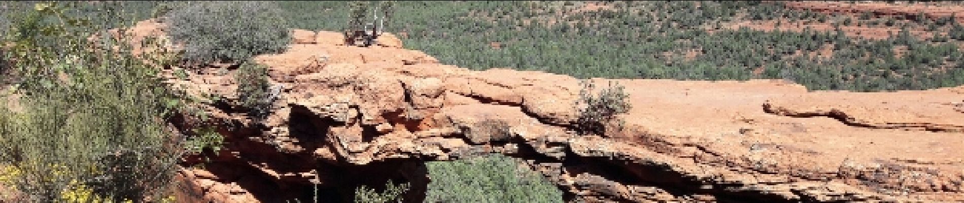
devil's Bridge

phi14
User
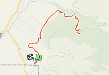

Length
7 km

Max alt
1525 m

Uphill gradient
160 m
Km-Effort
9.2 km

Min alt
1405 m

Downhill gradient
161 m
Boucle
Yes
Creation date :
2017-04-04 00:00:00.0
Updated on :
2017-04-04 00:00:00.0
2h02
Difficulty : Easy

FREE GPS app for hiking
 SityTrail
IGN / Geographical institutes
SityTrail Plus
The world is yours!
About
Trail Walking of 7 km to be discovered at Arizona, Yavapai County. This trail is proposed by phi14.
Photos


Positioning
Country:
United States
Region :
Arizona
Department/Province :
Yavapai County
Municipality :
Unknown
Location:
Unknown
Start:(Dec)
Start:(UTM)
425005 ; 3861195 (12S) N.
Comments