


Canyon de l'Infernet

rigol05
User

Length
13.6 km

Max alt
1105 m

Uphill gradient
488 m
Km-Effort
20 km

Min alt
798 m

Downhill gradient
483 m
Boucle
Yes
Creation date :
2016-09-20 00:00:00.0
Updated on :
2016-09-20 00:00:00.0
4h25
Difficulty : Medium

FREE GPS app for hiking
 SityTrail
IGN / Geographical institutes
SityTrail Plus
The world is yours!
About
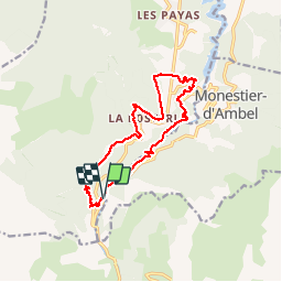
Trail Walking of 13.6 km to be discovered at Auvergne-Rhône-Alpes, Isère, Pellafol. This trail is proposed by rigol05.
Description
Au départ du parking des Gillardes, circuit longeant la Souloise en passant par le canyon de l'Infernet. Retour par l'ancien canal de Pellafol.
Positioning
Country:
France
Region :
Auvergne-Rhône-Alpes
Department/Province :
Isère
Municipality :
Pellafol
Location:
Unknown
Start:(Dec)
Start:(UTM)
728527 ; 4960041 (31T) N.
Comments
Très jolie randonnée majoritairement sous bois avec de jolis points de vue.