


LE CHATEL depuis MENS-25-09-2016

RD78-38
User
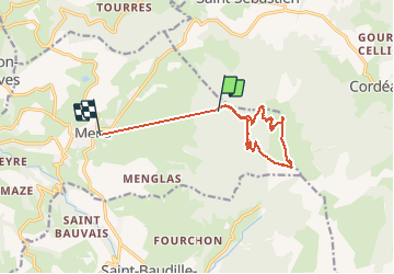

Length
11.9 km

Max alt
1930 m

Uphill gradient
641 m
Km-Effort
22 km

Min alt
782 m

Downhill gradient
1157 m
Boucle
No
Creation date :
2017-07-29 00:00:00.0
Updated on :
2020-07-11 00:22:07.315
4h20
Difficulty : Easy

FREE GPS app for hiking
 SityTrail
IGN / Geographical institutes
SityTrail Plus
The world is yours!
About
Trail Walking of 11.9 km to be discovered at Auvergne-Rhône-Alpes, Isère, Mens. This trail is proposed by RD78-38.
Description
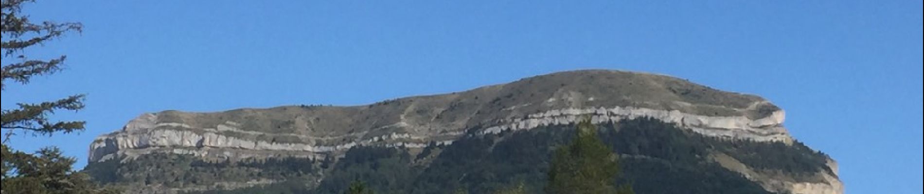
Randonnée sans difficultés avec une très belle vue à 360 degrés au sommet du "Bonnet de Calvin"
Photos


Positioning
Country:
France
Region :
Auvergne-Rhône-Alpes
Department/Province :
Isère
Municipality :
Mens
Location:
Unknown
Start:(Dec)
Start:(UTM)
720630 ; 4966947 (31T) N.
Comments