


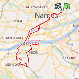
Ile de Nantes - Trentemoult

eric.deniau
User

Length
17.3 km

Max alt
28 m

Uphill gradient
150 m
Km-Effort
19.3 km

Min alt
-6 m

Downhill gradient
150 m
Boucle
Yes
Creation date :
2016-10-08 00:00:00.0
Updated on :
2016-10-08 00:00:00.0
4h14
Difficulty : Unknown

FREE GPS app for hiking
 SityTrail
IGN / Geographical institutes
SityTrail Plus
The world is yours!
About
Trail Walking of 17.3 km to be discovered at Pays de la Loire, Loire-Atlantique, Nantes. This trail is proposed by eric.deniau.
Positioning
Country:
France
Region :
Pays de la Loire
Department/Province :
Loire-Atlantique
Municipality :
Nantes
Location:
Unknown
Start:(Dec)
Start:(UTM)
610881 ; 5230698 (30T) N.
Comments