


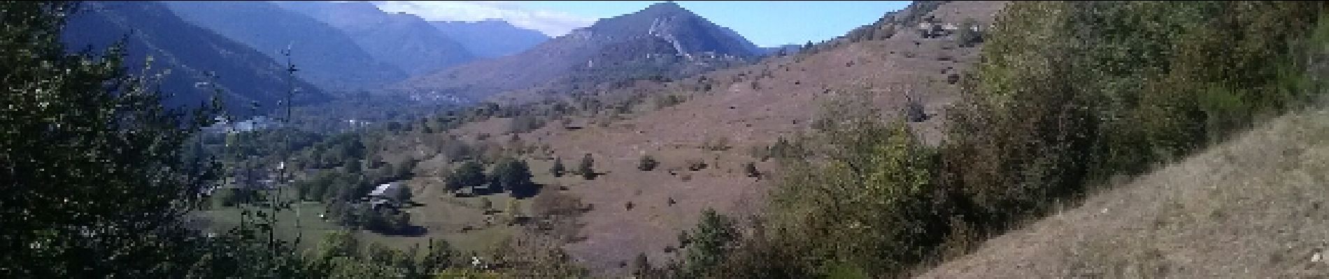
Vallée de Caussou

c.chehere
User
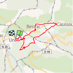

Length
9.1 km

Max alt
869 m

Uphill gradient
257 m
Km-Effort
12.5 km

Min alt
678 m

Downhill gradient
254 m
Boucle
Yes
Creation date :
2016-10-08 00:00:00.0
Updated on :
2016-10-08 00:00:00.0
2h53
Difficulty : Easy

FREE GPS app for hiking
 SityTrail
IGN / Geographical institutes
SityTrail Plus
The world is yours!
About
Trail Walking of 9.1 km to be discovered at Occitania, Ariège, Unac. This trail is proposed by c.chehere.
Description
Belle balade facile Itinéraire décrit dans le guide N°1 édité par la communauté de commune "Vallées d'Ax" Le retour s'effectue en partie sur des routes Prudence
Photos


Positioning
Country:
France
Region :
Occitania
Department/Province :
Ariège
Municipality :
Unac
Location:
Unknown
Start:(Dec)
Start:(UTM)
399838 ; 4735061 (31T) N.
Comments