


Ardèche-160927 - Gournier-Sauze

randodan
User
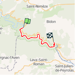

Length
16.1 km

Max alt
276 m

Uphill gradient
465 m
Km-Effort
23 km

Min alt
44 m

Downhill gradient
537 m
Boucle
No
Creation date :
2016-12-18 00:00:00.0
Updated on :
2016-12-18 00:00:00.0
9h00
Difficulty : Medium

FREE GPS app for hiking
 SityTrail
IGN / Geographical institutes
SityTrail Plus
The world is yours!
About
Trail Walking of 16.1 km to be discovered at Auvergne-Rhône-Alpes, Ardèche, Saint-Remèze. This trail is proposed by randodan.
Description
En Cours
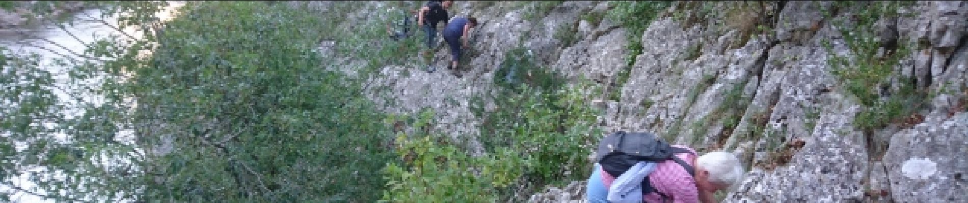
Photos


Positioning
Country:
France
Region :
Auvergne-Rhône-Alpes
Department/Province :
Ardèche
Municipality :
Saint-Remèze
Location:
Unknown
Start:(Dec)
Start:(UTM)
617138 ; 4912472 (31T) N.
Comments