


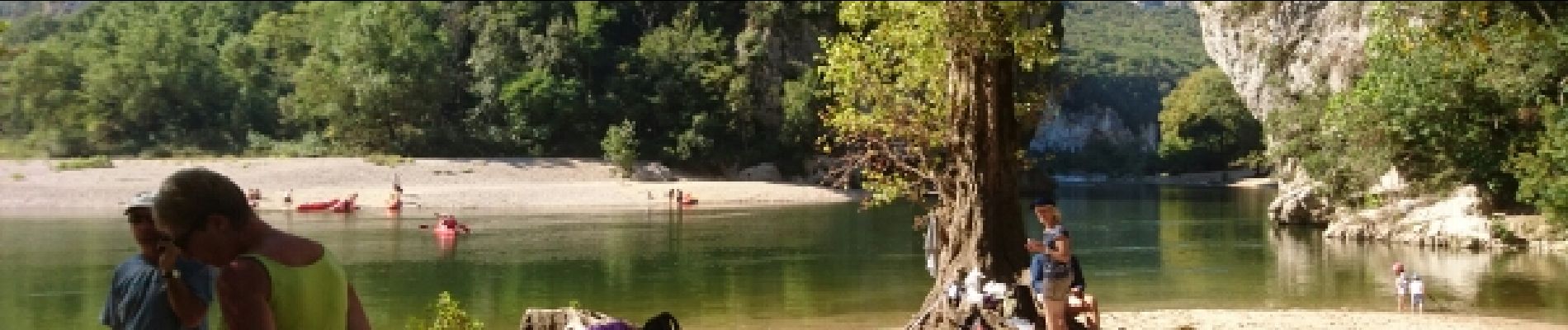
Ardèche-160929 - PontDarc-GteChauvet

randodan
User
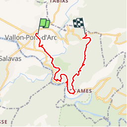

Length
12.7 km

Max alt
330 m

Uphill gradient
526 m
Km-Effort
19.2 km

Min alt
80 m

Downhill gradient
362 m
Boucle
No
Creation date :
2016-12-31 00:00:00.0
Updated on :
2016-12-31 00:00:00.0
4h40
Difficulty : Easy

FREE GPS app for hiking
 SityTrail
IGN / Geographical institutes
SityTrail Plus
The world is yours!
About
Trail Walking of 12.7 km to be discovered at Auvergne-Rhône-Alpes, Ardèche, Vallon-Pont-d'Arc. This trail is proposed by randodan.
Description
En Cours
Photos


Positioning
Country:
France
Region :
Auvergne-Rhône-Alpes
Department/Province :
Ardèche
Municipality :
Vallon-Pont-d'Arc
Location:
Unknown
Start:(Dec)
Start:(UTM)
611313 ; 4917936 (31T) N.
Comments