


SVG 161001

randodan
User

Length
11.5 km

Max alt
227 m

Uphill gradient
305 m
Km-Effort
15.6 km

Min alt
129 m

Downhill gradient
297 m
Boucle
No
Creation date :
2016-10-12 00:00:00.0
Updated on :
2016-10-12 00:00:00.0
4h26
Difficulty : Unknown

FREE GPS app for hiking
 SityTrail
IGN / Geographical institutes
SityTrail Plus
The world is yours!
About
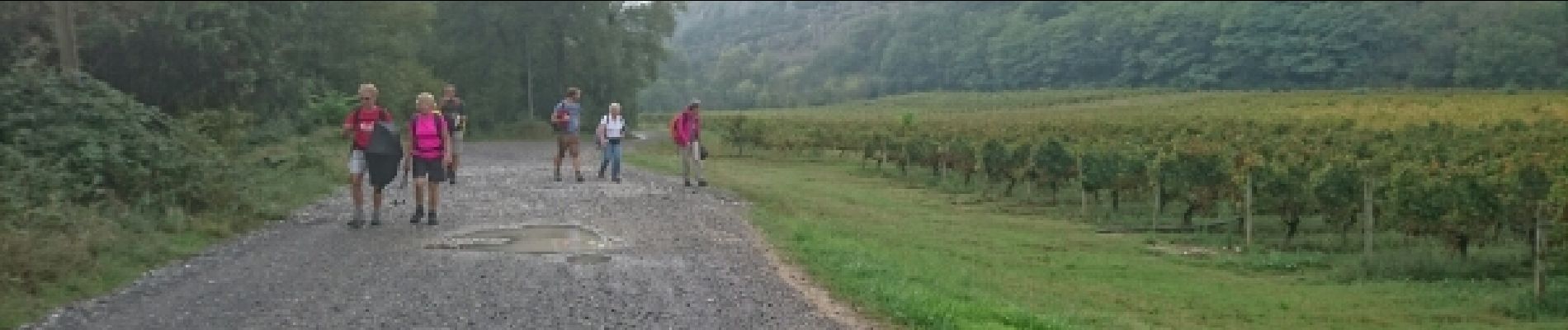
Trail Walking of 11.5 km to be discovered at Auvergne-Rhône-Alpes, Ardèche, Chauzon. This trail is proposed by randodan.
Photos


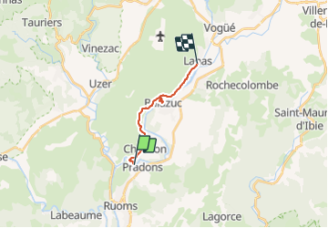
Positioning
Country:
France
Region :
Auvergne-Rhône-Alpes
Department/Province :
Ardèche
Municipality :
Chauzon
Location:
Unknown
Start:(Dec)
Start:(UTM)
607477 ; 4925607 (31T) N.
Comments