


lynde

jeanluc59
User
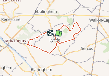

Length
12.9 km

Max alt
70 m

Uphill gradient
104 m
Km-Effort
14.3 km

Min alt
38 m

Downhill gradient
104 m
Boucle
Yes
Creation date :
2016-10-13 00:00:00.0
Updated on :
2016-10-13 00:00:00.0
3h00
Difficulty : Easy

FREE GPS app for hiking
 SityTrail
IGN / Geographical institutes
SityTrail Plus
The world is yours!
About
Trail Walking of 12.9 km to be discovered at Hauts-de-France, Nord, Lynde. This trail is proposed by jeanluc59.
Description
du bonsberg à la becquerelle
Positioning
Country:
France
Region :
Hauts-de-France
Department/Province :
Nord
Municipality :
Lynde
Location:
Unknown
Start:(Dec)
Start:(UTM)
459012 ; 5618019 (31U) N.
Comments