


ponet

raygautier
User
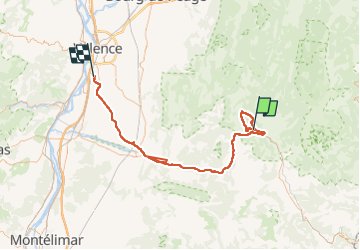

Length
92 km

Max alt
1013 m

Uphill gradient
1527 m
Km-Effort
113 km

Min alt
109 m

Downhill gradient
1795 m
Boucle
No
Creation date :
2016-11-04 00:00:00.0
Updated on :
2022-10-05 08:53:30.341
13h34
Difficulty : Medium

FREE GPS app for hiking
 SityTrail
IGN / Geographical institutes
SityTrail Plus
The world is yours!
About
Trail Other activity of 92 km to be discovered at Auvergne-Rhône-Alpes, Drôme, Ponet-et-Saint-Auban. This trail is proposed by raygautier.
Description
Ponet


Positioning
Country:
France
Region :
Auvergne-Rhône-Alpes
Department/Province :
Drôme
Municipality :
Ponet-et-Saint-Auban
Location:
Unknown
Start:(Dec)
Start:(UTM)
683604 ; 4960367 (31T) N.
Comments