


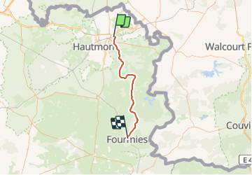
Nord - Pas-de-Calais - Ligne 240 - Maubeuge - Fourmies

mich54
User


5m
Difficulty : Unknown

FREE GPS app for hiking
 SityTrail
IGN / Geographical institutes
SityTrail Plus
The world is yours!
About
Trail Other activity of 38 km to be discovered at Hauts-de-France, Nord, Rousies. This trail is proposed by mich54.
Description
La ligne de Maubeuge à Fourmies était une ligne ferroviaire non électrifiée à voie unique, inaugurée le 29 août 1885, qui reliait la gare de Maubeuge à celle de Fourmies. L'embryon de cette ligne est un embranchement à usage industriel mis en service le 29 octobre 1860. (Source Wikipédia)
Positioning
Comments