Trail Other activity Hénin-Beaumont - Nord - Pas-de-Calais - Ligne 285 - Hénin-Beaumont - Bauvin-Provin - Photo

Nord - Pas-de-Calais - Ligne 285 - Hénin-Beaumont - Bauvin-Provin

 mich54
mich54

User

© OpenStreetMap contributors
Length
Length
12.7 km
Max alt
Max alt
39 m
Uphill gradient
Uphill gradient
65 m
Km-Effort
Km-Effort  
13.5 km
Min alt
Min alt
18 m
Downhill gradient
Downhill gradient
66 m
Boucle
Boucle
No
Creation date :
2016-11-04 00:00:00.0
Updated on :
2016-11-04 00:00:00.0

(0 Reviews)

Other activity
Other activity
5m
Difficulty : Unknown

Scan this QR Code to open this trail in the SityTrail application

FREE GPS app for hiking

Logo SityTrail SityTrail

IGN / Geographical institutes

Download SityTrail from the App Store Download SityTrail from Google Play

Logo SityTrail SityTrail Plus

The world is yours!

Download SityTrail from the App Store Download SityTrail from Google Play Download SityTrail on Huawei AppGallery

About

Trail Other activity of 12.7 km to be discovered at Hauts-de-France, Pas-de-Calais, Hénin-Beaumont. This trail is proposed by mich54.

Description

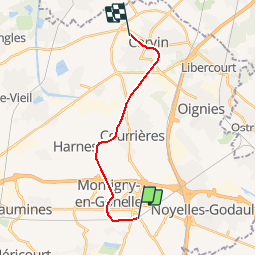
Section de Hénin-Beaumont à Carvin, le reste du parcours n'est pas visible.
La ligne d'Hénin-Beaumont à Bauvin - Provin était une ligne de chemin de fer d'une longueur de 15,1 kilomètres reliant la gare d'Hénin-Beaumont à celle de Bauvin - Provin, dans les départements français du Nord et du Pas-de-Calais.

Ouverte en 1879 par la Compagnie du chemin de fer de Lille à Valenciennes et ses Extensions, la ligne ferme aux voyageurs en 1938, puis progressivement au trafic des marchandises après la Seconde Guerre mondiale.(Source Wikipédia)

Elevation profile

Positioning

Country:
France
Region :
Hauts-de-France
Department/Province :
Pas-de-Calais
Municipality :
Hénin-Beaumont
Location:
Unknown
Start:(UTM)
496496 ; 5584900 (31U) N.


Close
My subscriptions