


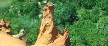
Colorado provensal Rustrel

Cricounet84
User
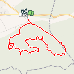

Length
7.2 km

Max alt
431 m

Uphill gradient
132 m
Km-Effort
8.9 km

Min alt
353 m

Downhill gradient
129 m
Boucle
Yes
Creation date :
2014-12-10 00:00:00.0
Updated on :
2014-12-10 00:00:00.0
4h25
Difficulty : Easy

FREE GPS app for hiking
 SityTrail
IGN / Geographical institutes
SityTrail Plus
The world is yours!
About
Trail Walking of 7.2 km to be discovered at Provence-Alpes-Côte d'Azur, Vaucluse, Rustrel. This trail is proposed by Cricounet84.
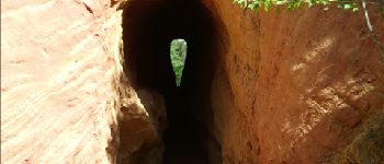
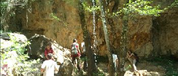
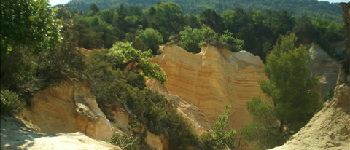
Photos


Positioning
Country:
France
Region :
Provence-Alpes-Côte d'Azur
Department/Province :
Vaucluse
Municipality :
Rustrel
Location:
Unknown
Start:(Dec)
Start:(UTM)
700725 ; 4865935 (31T) N.
Comments
superbe balade. Des chemins fermés définitivement, mais on retrouve vite la trace de la randonnée.
Très belle ballade. dommage que le parking soit payant. a faire hors été ...