


Marche Chatelneuf

ramsay
User

Length
13.1 km

Max alt
956 m

Uphill gradient
399 m
Km-Effort
18.4 km

Min alt
647 m

Downhill gradient
388 m
Boucle
Yes
Creation date :
2016-11-22 00:00:00.0
Updated on :
2016-11-22 00:00:00.0
3h56
Difficulty : Medium

FREE GPS app for hiking
 SityTrail
IGN / Geographical institutes
SityTrail Plus
The world is yours!
About
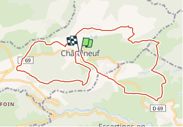
Trail Walking of 13.1 km to be discovered at Auvergne-Rhône-Alpes, Loire, Châtelneuf. This trail is proposed by ramsay.
Description
Téléthon 2016 - parcours 13,5 km
Positioning
Country:
France
Region :
Auvergne-Rhône-Alpes
Department/Province :
Loire
Municipality :
Châtelneuf
Location:
Unknown
Start:(Dec)
Start:(UTM)
576544 ; 5054210 (31T) N.
Comments