


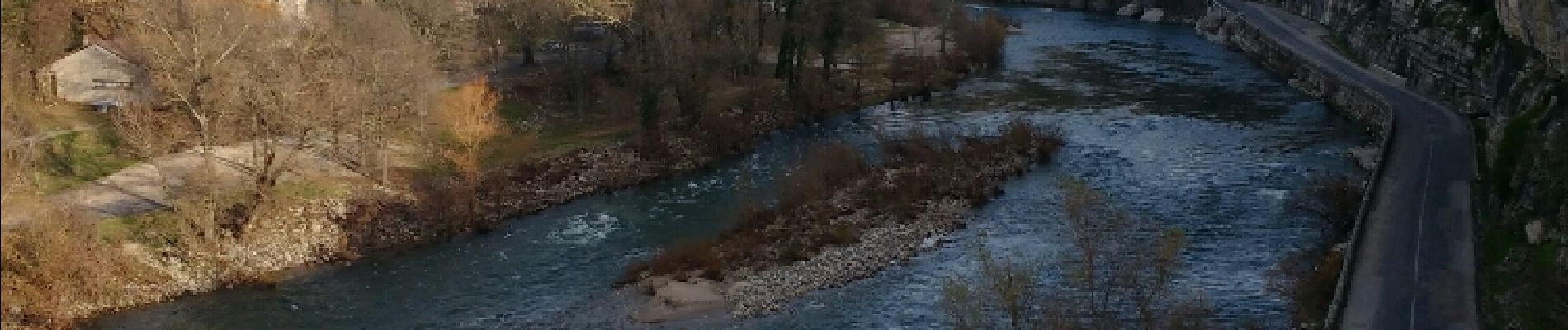
trace Voguë_Lanas-La Lichette

coureursdecretes
User
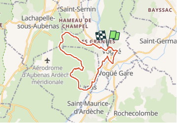

Length
14.4 km

Max alt
311 m

Uphill gradient
341 m
Km-Effort
19 km

Min alt
141 m

Downhill gradient
343 m
Boucle
Yes
Creation date :
2016-11-28 00:00:00.0
Updated on :
2021-09-27 18:30:38.471
4h45
Difficulty : Unknown

FREE GPS app for hiking
 SityTrail
IGN / Geographical institutes
SityTrail Plus
The world is yours!
About
Trail Walking of 14.4 km to be discovered at Auvergne-Rhône-Alpes, Ardèche, Vogüé. This trail is proposed by coureursdecretes.
Photos


Positioning
Country:
France
Region :
Auvergne-Rhône-Alpes
Department/Province :
Ardèche
Municipality :
Vogüé
Location:
Unknown
Start:(Dec)
Start:(UTM)
612245 ; 4934160 (31T) N.
Comments