


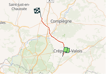
Picardie - Ligne 232 - Ormoy-Villers - Boves (section de Estrées-St-Denis à Ormoy-Villers)

mich54
User


5m
Difficulty : Unknown

FREE GPS app for hiking
 SityTrail
IGN / Geographical institutes
SityTrail Plus
The world is yours!
About
Trail Other activity of 35 km to be discovered at Hauts-de-France, Oise. This trail is proposed by mich54.
Description
La ligne d'Ormoy-Villers à Boves est une ligne ferroviaire qui relie la banlieue parisienne nord-est à la région d'Amiens. Très utilisée au temps de la traction à vapeur pour acheminer le charbon du bassin houiller du nord de la France vers la région parisienne, en évitant ainsi l'emprunt de la section Amiens - Paris très chargée, elle est utilisée aujourd'hui pour le trafic des marchandises entre Ormoy-Villers et la ligne de Creil à Jeumont et en trafic voyageurs entre Estrées-Saint-Denis et Boves (relation entre Compiègne et Amiens).
Elle constitue la ligne 232 0001 du réseau ferré national.(Source Wikipédia)
Positioning
Comments