


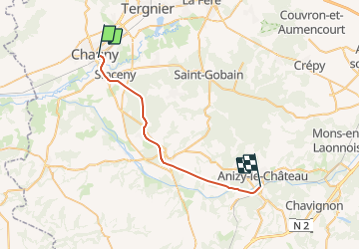
Picardie - Ligne 234 - Anizy-Pinon - Chauny

mich54
User


5m
Difficulty : Unknown

FREE GPS app for hiking
 SityTrail
IGN / Geographical institutes
SityTrail Plus
The world is yours!
About
Trail Other activity of 25 km to be discovered at Hauts-de-France, Aisne, Chauny. This trail is proposed by mich54.
Description
La ligne d'Anizy-Pinon à Chauny est une ligne de chemin de fer française à écartement standard et à voie unique non électrifiée. Elle reliait les villes d'Anizy-Le-Château et de Chauny à travers la forêt de Saint-Gobain, elle desservait notamment Coucy-le-Château-Auffrique et Folembray.
Elle constituait la ligne 234 0001 du réseau ferré national.
Le trafic voyageur fut substitué par autocar le 22 mai 1937.(Source Wikipédia)
Positioning
Comments