


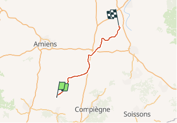
Picardie - Ligne 259 - Saint-Just-en-Chaussée - Douai (Section de St-Just à Epehy)

mich54
User


5m
Difficulty : Unknown

FREE GPS app for hiking
 SityTrail
IGN / Geographical institutes
SityTrail Plus
The world is yours!
About
Trail Other activity of 94 km to be discovered at Hauts-de-France, Oise, Saint-Just-en-Chaussée. This trail is proposed by mich54.
Description
La ligne de Saint-Just-en-Chaussée à Douai est une ligne ferroviaire française partiellement à voie unique, reliant Saint-Just-en-Chaussée à Douai en passant par Montdidier, Péronne et Cambrai.
Partiellement déclassée entre Péronne et Cambrai, elle constitue la ligne no 259 0001 du réseau ferré national.(Source Wikipédia)
Positioning
Comments