


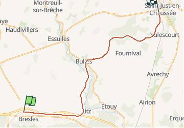
Picardie - Ligne 318 - La Rue-Saint-Pierre - Saint-Just-en-Chaussée

mich54
User


5m
Difficulty : Unknown

FREE GPS app for hiking
 SityTrail
IGN / Geographical institutes
SityTrail Plus
The world is yours!
About
Trail Other activity of 22 km to be discovered at Hauts-de-France, Oise, Bresles. This trail is proposed by mich54.
Description
La ligne de La-Rue-Saint-Pierre à Saint-Just-en-Chaussée est une ancienne ligne de chemin de fer du réseau ferré français. Elle reliait La Rue-Saint-Pierre - La Neuville-en-Hez à Saint-Just-en-Chaussée à travers le département de l'Oise en région Picardie.
Elle constituait la ligne 318 000 du réseau ferré national.
Dates de déclassement
Bulles à Saint-Just-en-Chaussée (PK 25,400 à 35,110) : 12 novembre 1954.
La Rue-Saint-Pierre à Bulles (PK 19,420 à 25,400) : 27 juillet 1973.(Source Wikipédia)
Positioning
Comments