


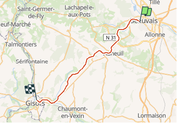
Picardie - Ligne 332 - Beauvais - Gisors-Embranchement par Goincourt

mich54
User


5m
Difficulty : Unknown

FREE GPS app for hiking
 SityTrail
IGN / Geographical institutes
SityTrail Plus
The world is yours!
About
Trail Other activity of 32 km to be discovered at Hauts-de-France, Oise, Beauvais. This trail is proposed by mich54.
Description
La ligne de Beauvais à Gisors-Embranchement est une ligne de chemin de fer du réseau ferré français à écartement standard. Elle reliait Beauvais à Gisors à travers les départements de l'Oise et de l'Eure et des régions Picardie et Haute-Normandie.
Elle constitue la ligne n°332 0001 du réseau ferré national.
Positioning
Comments