


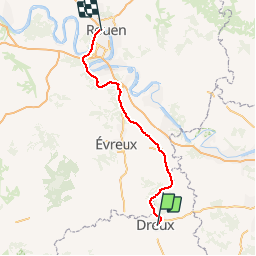
Haute-Normandie - Ligne 00C - Rouen - Orléans (Section de Rouen à Dreux)

mich54
User


5m
Difficulty : Unknown

FREE GPS app for hiking
 SityTrail
IGN / Geographical institutes
SityTrail Plus
The world is yours!
About
Trail Other activity of 111 km to be discovered at Centre-Loire Valley, Eure-et-Loir, Dreux. This trail is proposed by mich54.
Description
La ligne Rouen - Orléans est une ancienne ligne commerciale française de chemin de fer, qui reliait Rouen à Orléans. Mise en service par étapes entre 1872 et 1883, la ligne est fermée au trafic voyageur depuis la Seconde Guerre mondiale. Seule la section de Chartres à Orléans est encore en service et accueille un trafic marchandises saisonnier, principalement céréalier.(Source Wikipédia)
Positioning
Comments