


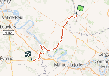
Haute - Normandie - Ligne 339 - Gisors-Boisgeloup - Pacy-sur-Eure

mich54
User


5m
Difficulty : Unknown

FREE GPS app for hiking
 SityTrail
IGN / Geographical institutes
SityTrail Plus
The world is yours!
About
Trail Other activity of 62 km to be discovered at Normandy, Eure, Gisors. This trail is proposed by mich54.
Description
La ligne de Gisors-Boisgeloup à Pacy-sur-Eure est une ancienne ligne de chemin de fer secondaire à voie normale de 56,1 km de longueur, située dans l'Eure et le Val-d'Oise. Elle permet en particulier de relier Gisors à Vernon et de desservir la basse vallée de l'Epte, frontière historique du Vexin français et du Vexin normand. Elle constitue la ligne 339 000 du réseau ferré national.Le tronçon de Vernon à Pacy-sur-Eure est fermé aux voyageurs le 1er juillet 1939, suivi par celui de Gisors-Boisgeloup à Vernon, le 1er mars 1940.(Source Wikipédia)
Positioning
Comments