


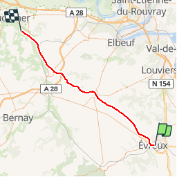
Haute Normandie - Ligne 375 - Évreux-Embranchement - Quetteville 1

mich54
User


5m
Difficulty : Unknown

FREE GPS app for hiking
 SityTrail
IGN / Geographical institutes
SityTrail Plus
The world is yours!
About
Trail Other activity of 55 km to be discovered at Normandy, Eure, Évreux. This trail is proposed by mich54.
Description
La ligne d'Évreux-Embranchement à Quetteville est une ligne de chemin de fer française qui reliait Évreux (Eure) à Quetteville (Calvados).
Elle constitue la ligne 375 000 du réseau ferré national.
Seule une section de la ligne reste ouverte pour le fret entre la gare de Glos-Montfort et celle de Quetteville.
La ligne est fermée au trafic voyageurs en 1969. Le trafic fret est interrompu entre Évreux et le Neubourg en 1990.(Source Wikipédia)
Section de Evreux-Embranchement - Condé-sur-Risle
Positioning
Comments